Sublime
An inspiration engine for ideas
The USGS #LandsatArchive holds more than 50 years of satellite-based #EarthObservation data. Greater than 11 million Level-1 scenes are available for download from #EarthExplorer. Some locations in the world have upwards of 2,000 scenes. Explore more here: https://t.co/CzLlH9e4mu https://t.co/gMOZ7puSxg
USGS Landsatx.com7 days of wildfires in the us————visualized by custom-written layers & shaders w/ deckgl https://t.co/pXsLu0Dj6q
daniel pethox.com
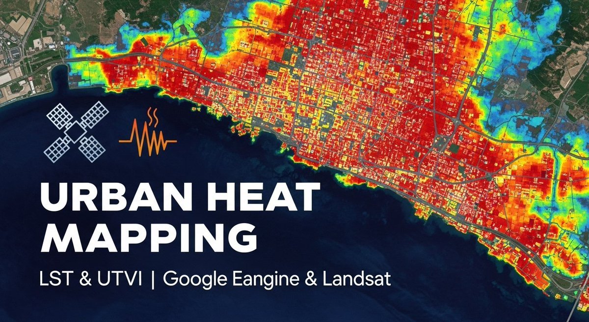
Mapping Urban Heat Islands with LST & UTFVI | Google Earth Engine & Landsat
Tutorial link: https://t.co/x04u6M3JzA
For more information about registration, visit our website: https://t.co/i4EFoxX5HU
#UrbanHeatIsland #LST #UTFVI #GoogleEarthEngine #Landsat #RemoteSensing https://t.co/IoIUpa4hZu
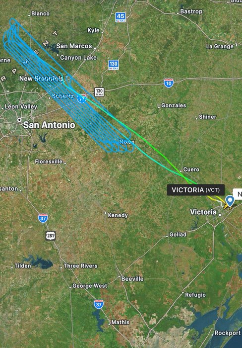
@rawsalerts Owned by Marc Inc which carries out a lot of airborne GIS, survey and surveillance projects.
Flight path looks like it was out on a project for ~5 hours. https://t.co/M1czVKOMwp

Map status for an app that allows the detection and prediction of wildfire spread https://t.co/1bA929osGV
Home 2025 | ASCE's 2025 Infrastructure Report Card
infrastructurereportcard.org
🌾 How healthy are the world’s ecosystems?
Using two decades of Landsat imagery & a light use efficiency model, Land & Carbon Lab & Global Pasture Watch have created the first global maps of Gross Primary Productivity at 30 m resolution.
➡️ https://t.co/dLXdBnZyJc https://t.co/fMupRWtVHE
landcarbonlabx.com