Sublime
An inspiration engine for ideas
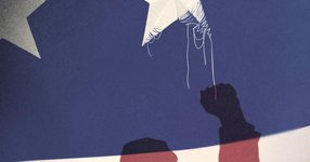
At the heart of our divisions is almost half a century of rising inequality and declining social mobility. Americans tolerate more economic inequality than citizens of other modern democracies: if anyone can become anything, today’s unequal results are fair and might well change tomorrow. That was never completely true, but now it’s plainly false.
... See moreGeorge Packer • Last Best Hope: America in Crisis and Renewal
In the end, McCain and Palin weren’t much impeded by their colonial entanglements. They were white, and they projected an image of being “American”—McCain a war hero from a military family, Palin a fierce defender of what she called “the real America.” The same immunity was not enjoyed by their opponent in the 2008 election, Barack Obama. On paper,
... See moreDaniel Immerwahr • How to Hide an Empire
To be an American is to be infused with the plantation South, with its Black vernacular, its insurgency, and also its brutal masculinity, its worship of Whiteness, its expulsion and its massacres, its self-defeating stinginess and unapologetic pride.
Imani Perry • South to America: A Journey Below the Mason-Dixon to Understand the Soul of a Nation
the veil lifted. Is that where the “lazy white Southerner” stereotype came from? Is that why Southern whites looked funny—lanky, pale, and slack? Page introduced Stiles to John D. Rockefeller’s aide, who arranged for the oil baron to give a million dollars to deworm the South. This was an early venture by Rockefeller into philanthropy, which would
... See moreDaniel Immerwahr • How to Hide an Empire
William (Willi) F. Unsoeld, Ph.D.: 36, Corvallis, Oregon; Assistant Professor, Department of Philosophy and Religion, Oregon State University, on leave as deputy Peace Corps representative in Nepal; Climbing leader.
Thomas F. Hornbein • Everest: The West Ridge, Anniversary Edition
Ray Dalio put out a (somewhat euphemistic) model of how the US order could fall to an external competitor, and Peter Turchin put out a (less euphemistic) model of how the US could fall into internal disorder.
Balaji Srinivasan • The Network State: How To Start a New Country
